
Questions about the service
What does burn severity measure?
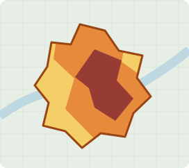
Burn severity describes changes detected in satellite observations after a fire. It supports assessment of the affected vegetation and ground surface. Financial loss and tree mortality need additional evidence and interpretation.
Can you assess historical fires?
Yes. We first check whether the satellite archive contains suitable observations for the location and dates requested. Historical assessments can support claims review and comparisons across fire seasons.
What happens when clouds or smoke obscure the area?
We check the available images when we receive your request and explain any gaps. If coverage is incomplete, we agree what can be assessed and the price before processing. Delivery timing depends on suitable imagery and the agreed scope.
Which regions can you cover?
We have global coverage. Send us the location and dates you need, and we will check imagery availability before confirming your order.
How is the service priced?
Pricing depends on the agreed analysis area, selected products and delivery scope. We confirm the price before processing; you can order burned-area mapping, burn severity or both.
Can this support our claims process?
Yes. The assessment can provide evidence for your existing process. For wider claims workflows, see our Claims Management System.